Sturgis 2006: Days 1 & 2 – Riding from Des Moines to Belle Fourche
by Corn Dog on August 26, 2006
in Sturgis 2006
See all photos from days 1 & 2
DAY ONE:
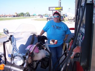
Our Sturgis adventure began with rain. We had dropped the dog at the kennel, and our daughter at her friend’s house, on Friday evening and were ready to leave early Saturday morning, August 4. No trouble getting up at 5 a.m. – I don’t think we really slept all that well to start with. With only minimal delays we were at the gas station at 6:30 and noticing the clouds in the west. We gassed up, then hopped onto I-80 west-bound… and within three miles, felt the water start to fall. Pulled off at a rest area to put on our rain suits (we knew we’d use them eventually – but, five miles from home??) then headed off again. The rain came down hard for probably 30 minutes – I was in the lead and could barely see, but I thought, ‘well this is riding in the rain so I’d better get used to it.’ As it turns out, it was really hard rain comparatively speaking, and Steve says I should have pulled over for it. Woops! We rode in the rain for awhile – and every time a truck passed all I could think of was, I’m drinking that filthy wash coming up off his tires! Eventually – mercifully – the rain slowed then stopped.
Our first gas stop was in Walnut, Iowa, about 85 miles from home. (Did I mention I’m on a Sportster? I never wanted to run out of gas, so I had planned stops about every 90 miles or so – some more, some less, but overall this plan would 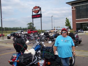 serve us well!) We took off our wet gear – my leather fingerless gloves had left a blue-ish dye all over my hands in a pattern resembling extensive tribal-style tattoos. Dried out a bit and then headed westward again, from I-80 to 680 west and then I-29 North. Next gas stop, “Dave’s World” at Onawa, Iowa… then on to Sioux City where we made an unplanned stop at the HD dealership to purchase a replacement nut to hold my luggage rack onto the fender – mine had vibrated off somewhere along the way already! Bought some t-shirts at Rooster’s HD and then onward to the next gas/lunch stop at Beresford, SD – the Super 8 here is where we’d be staying overnight on our return trip… another stop at the Sioux Falls, SD HD dealership off I-29 for a big “welcome bikers” party, where I saw my next bike: a 2007 Low Rider in Blue Denim & Vivid Black. We rolled into Mitchell, SD about 5 p.m. – 11 hours to go 350 miles! Our motel (reserved in advance) was a Best Western, quite decent with an ice-cold air conditioner (critical equipment for Steve) and across the street from a good steakhouse. After our steak dinner we were ready for bed, and asleep before 10 p.m.
DAY TWO:
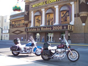 The next morning we slept a little later than planned but discovered that this motel had another nice feature: a working waffle iron in the lobby with pre-measured cups of batter, plus butter and syrup to make a free, hearty breakfast. Re-packed the bikes and decided to run over to the tourist stop Mitchell is famous for: the Corn Palace, a big building covered in kernels of corn. We probably should have taken time to go inside for the complete tourist experience, but we were anxious to get on the road so we paused long enough to take some pictures and headed west again on I-90 around 10 a.m.
The weather for Day 2 was beautiful – hot, but not humid… nary a drop of rain as we rode! Gas stops were in Kennebec and Kadoka, and we made a scenic stop at the Lewis and Clark Rest Area outside Chamberlain, SD with a beautiful view of the Missouri River (L&C Slept Here). And of course we stopped in Wall, where we visited the must-see Wall Drug for lunch and a little souvenir shopping. (I am SUCH a sucker for these things – I LOVE Wall Drug with its cheesey fake-Indian beaded belts and Beanie-Baby-size Jackalopes…) A couple more photos, and we were on to Rapid City for our final gas stop before our destination.
I think we rolled past Sturgis on I-90 around 5 p.m. and got our first glimpse of what a true cluster-fuck it is… It was a 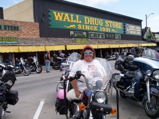 great feeling to know we’d made it that far, but we still had an hour or so to go as we were staying in Belle Fourche which is about 30 miles farther north and a little west. We turned north onto US 34 just outside of Sturgis and took that straight into Belle Fourche – heavy crosswinds kept us on our toes for the last 17 miles up 34, and our little motel (The Raptor’s Nest Inn) was a welcome sight off to our right when we came to the Belle Fourche Junction. Garry and Shirley weren’t around when we arrived (they rolled in around 7:30 as an evening thunderstorm was ending) so we ordered a pizza and got unpacked. The motel was interesting – it’s run by a young couple who host “dinosaur digs” throughout the rest of the summer – he’s a paleontologist, she’s a former licensed massage-therapist-turned-fossil-restoration artist – anyway, the rooms had cute dinosaur themes and king-size beds… well okay, some had BUNK BEDS, but *we* had a king bed. Big *whew* on that one! At first we weren’t too impressed with the accommodations – this room cost the same as the Best Western from the night before – but as the week went on, the little AC unit was more than adequate and they even left it on for us throughout the day so our room was always cool when we rolled in. The only thing they could have done better was provided bigger bath soap, but we sure could solve that problem by making a run to the Family Dollar Store down the road. So overall, no complaints about the Raptor’s Nest Inn, and the owners were very interesting folks to talk with!
I noted the mileage for the first two days – 692 – and we were ready for our first trip down to Sturgis coming up on DAY THREE!
Sturgis 2006: Day 3, In Sturgis
by Corn Dog on August 25, 2006
in Sturgis 2006
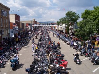 Monday, August 7 was our first trip down to Sturgis itself. Our friends, having stayed in this same motel last year, had found a route into Sturgis that was longer but had less traffic than the obvious I-90 path, so we took Hwy 212 out of Belle Fourche to Hwy 79, which took us straight past Bear Butte and deposited us at Thunder Alley where the Rat’s Hole Custom Bike Show would be held on Friday the 11th. Once we got to the road going into Sturgis alongside Thunder Alley, the traffic slowed down to stop-and-go for the mile or so on into town. We didn’t even try to park on Main Street, but instead parked in front of a house about two blocks away and walked in. The bustle and noise were awesome – yes there really were that many bikes!
I have to add here that Steve was making this trip with a disability – he had pinched a nerve in his back and standing/walking were barely possible for him. (Riding on the bike, however, was quite comfortable.) He was able to walk about ten minutes at a time and then would have to sit or at least find something to lean on that he could find a 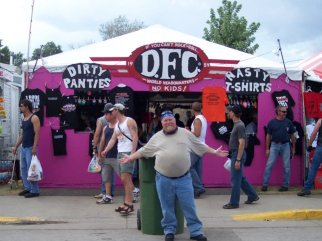 good position to relieve the burning in his hip and leg; I’m honestly not sure how he did it – he dug down into that reserve of stubbornness, I think, left over from his Marine Corps days, and just did it.
One of the first things I did was pay $5 for the opportunity to go up on a high platform and take some overhead pictures. I had had this idea myself when we used to go to the Street Rod Nationals – rent a scissor-lift and invite folks to pay for the privilege of going up to take overhead shots – so I thought it was in fact a great idea and my pictures turned out great. After that we just walked up and down Main and Lazelle Streets, going into vendors’ tents and stores at will, pausing to rest on benches when available, and snapping pictures of bikini-clad girls whenever possible without risking getting slapped. What we noticed, after only a short time of this, was that lots of the vendors were selling the same merchandise. (And, as usual, they didn’t have a lot of selection in plus sizes, especially for women. The men could find big t-shirts without much problem, but I saw NOTHING for women over a size 2x, and those were cut small. So, it looks like the suppliers of this merchandise still refuse to acknowledge that larger women ride and love motorcycles and biker clothing. I wasn’t surprised, but I was disappointed. I was able to buy shirts for all the small women on my souvenir list, but I couldn’t find one that fit me, a 3x.)
A few of the vendors caught my attention… the Nasty-T-Shirt shop where I saw these favorites: “I’m not a gynecologist but I’d like to take a look,” “Fuck you, you fucking fuck,” and “Nice Trailer, Pussy” and the place selling all manner of HD boots… I should’ve tried them on and bought a new pair. I’m not sure why I didn’t. There was also a shop where folks were selling hand-tooled, hand-dyed leather patches – one of them had that great “We Can Do it” Rosie the Riveter design on it (I have an embroidered patch with that design). Also, I gotta hand it to Hot Leathers – they have a huge presence in Sturgis and all their booths with lots of leather gear, shirts and jackets. I bought a nice vest that fits me a lot better than the one I had and doesn’t look as dorky.
At one point we decided to duck into the Sidehack covered patio for lunch and a beer, and while we were in there it started to rain. Lucky us, it was time to start the wet t-shirt contest anyway, so we stayed at our lunch table and watched the festivities. The girls looked like they were having a lot of fun – one of them I thought might’ve been a “ringer” hired to get things started, because when the DJ asked her if she’d participate she agreed without even a whimper of protest. Anyway, it rained really hard for about 2 hours as we sat there enjoying the show and our lunch, then it was time to press on. We stopped at a few more vendors on our way back to the bikes, then arrived at our parking spots to find that my poor helmet (hanging as it was from the bike) was full of water! Oh well, by this time it was really hot out so the dampness felt good.
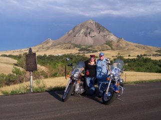 We took the same route home past Thunder Alley, up 79 past Bear Butte. We stopped at a historical marker near the Butte to take a few pictures, then headed back in to Belle Fourche under the threat of more rain. After dinner we talked about the fact that, overall, we were a little disappointed – was it really just a bunch of vendors and bikes trying to move down Main Street at a snail’s pace? Maybe we were just crabby because Steve was in pain. And, of course, if someone had asked us “Well, what were you expecting??”, we wouldn’t have had an intelligent answer. At any rate, we decided that we’d only go back into town on Friday, for the custom bike show. The rest of the trip would be scenic rides, starting with the day-long adventure down to Mt. Rushmore, planned for Day Four.
Sturgis 2006: Day 4 – Mt. Rushmore, Iron Mountain Road, Custer State Park, Needles Highway
by Corn Dog on August 24, 2006
in Sturgis 2006
This was going to be a big day. I had spent a lot of time at home, prior to the trip, planning a scenic trip for this day. I knew it totaled about 150 miles, but I couldn’t be exact. I had no idea how many hours it would take to do the ride as I’d laid it out, but the route I had selected included Mt. Rushmore (via Deadwood), Iron Mountain Road, Needles Highway, and Custer State Park Wildlife Loop. All of these had been suggested to me by friends on the Internet, but I had never traveled the roads myself so I didn’t know exactly what to expect. The only things I knew were that IMR and Needles Hwy were supposed to be very scenic, with lots of twisties and several switchbacks and tunnels. I was looking forward to the challenge of the twisties.
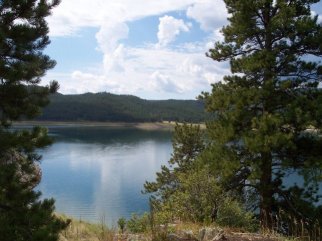 We set out in the morning from our motel in Belle Fourche. I was the one with the plan, so I was in the lead. Steve and Garry were going along for the full ride, but Shirley was going to spend the day in Deadwood, gambling. We took Highway 85 south out of Belle Fourche down to I-90, east briefly to pick up 85 South again and down into Deadwood. I must say I thought that last stretch of 85 was breathtaking – a wonderful sweeping curve down into town with pine-covered hills… it just felt very different (already!) than the cornfields of the Iowa countryside. We paused in Deadwood to make sure Shirley found a safe parking spot (there were thousands of bikes there that day as well) and bid farewell for the day, then followed 85 South til we picked up 385 South. Paused for a bathroom and photo break at Pactola Reservoir – kind of funny, because being in the lead but unfamiliar with the area, I pulled into a nicely-manicured turn-out that had a bathroom building with one mens’ and one womens’ stall. There were lots of bikes parked there, and lines for both stalls. Garry mentioned, as we were getting ready to go again, that just a hundred yards up the road was a really nice, full-service visitor center. He and Shirley had done last year exactly what I’d done this year – pulled into the first available driveway, not knowing that more and better services were available just around the bend. Back on the road, we took 385 South through Hill City – a slow ride down Main Street as there were ALSO lots of bikes there – and took a turn-off for Mt. Rushmore at Highway 244. This road was beautiful as well, and we soon came upon Rushmore.
Mt. Rushmore is billed as a national memorial. The last time we were here was in 1993, and the surrounding facilities 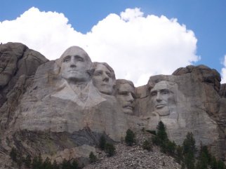 had changed quite a bit. For one thing they had built a three-level parking garage where before there had only been a flat parking lot. They had also built up the entrance and walkway that lead to the viewing area, and there were now concession stands (beverages and ice cream) just outside the gift shop and restaurant. These things hadn’t been here in ’93. We walked up to the viewing area and gazed at the monumental carving – I believe our Native Americans consider it a disgrace to put the faces of men on Nature’s mountain, but I for one feel it is quite beautiful and a moving tribute to the men who lead us through our Revolution, quest for independence, Civil War and pioneering of the West. We had been in the viewing area for about 20 minutes when we were treated to a “mountain rain shower,” so we ambled back down to the Gift shop where I purchased some souvenirs. We paused under a canopy to check the maps and it began raining in earnest at about that time. When we thought it seemed to be slowing down we headed to the parking garage, where our bikes and gear were dry. As we were suiting up in the rain gear the skies opened up big-time for about 10 minutes. When we eventually pulled out of the garage, the sun was out and it was extremely humid.
We traveled just few minutes east into Keystone, where we picked up Highway 16A, Iron Mountain Road. Heading south, the road quickly became one of the most beautiful and scenic I’d ever seen. There were sweeping curves and tighter S-turns to the left and right – with each one I would consciously set my line and dip the bike into each apex, only to quickly set-and-dip for the next curve. Some of the curves were very tight switchbacks which to my relief had much lower speed limits posted, as I’d been worried I might be too cautious and hold up traffic. The first of the one-lane tunnels came upon us and, because there was so much traffic both directions, it took us a little time to wait for the oncoming bikes to get through and give us an opening. The tunnels themselves are only about 14 feet wide and high, cut into the rock of the hill. Mt. Rushmore, now several miles behind us, is actually perfectly framed in one of them. What’s tricky is that the entrances to them are often at the end of a curve in the road, making them ‘blind’ – meaning, if you’re approaching, you can’t see that someone is in there coming out from the other direction. Extreme caution is essential.
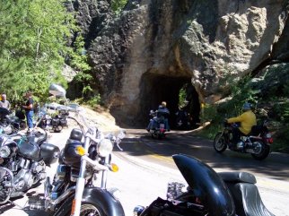 After one of the tunnels, we pulled into a turn-out to take a break and some pictures along with several other bikes, so we were on the side of the road just beyond the tunnel opening. The street was still wet, and the road was a blind curve on the downhill into the tunnel. I was getting the camera out of my saddlebag when I heard a skidding-on-pavement noise, and I looked up just in time to see a VRod slide right out from under its rider and skid to a stop on its side, and the rider go tumbling down a short embankment. I gasped, and he jumped right back up shouting, “I’m alright, I’m alright,” scrambling back to his bike in the road and trying to lift it. We looked at the people coming behind him down the road, expecting at least one of them to be going too fast and crash into him. Fortunately everyone was paying attention and it only took him a couple minutes to get the bike re-started. He was on his way within moments, and I couldn’t help but think how lucky he’d been. He hadn’t appeared to be injured, though he was wearing a tank shirt and shorts and no helmet. And, no one wrecked as he worked to get his bike re-started.
We had lots more beautiful scenery and twisty roads on the rest of IMR, then soon found ourselves entering Custer State Park. We paid the park usage fee and journeyed down the Wildlife Loop where we were hoping to spot some buffalo. A few miles in we hadn’t seen anything except a poor old jackrabbit who I thought was going to commit suicide under my bike. A bit later we passed an area where several bikers had stopped to feed and photograph a couple of wandering burros, but we kept going, figuring a trip to our local petting zoo back home would give us our burro fix if we felt the need. Finally, we rounded a curve and there was a large, wide-open area, with maybe 100-200 buffalo grazing and resting. Lots of bikers had pulled over here, so we did as well and took several photos. (We commented later how convenient it was that the buffalo had gathered at the point in the park where the road was plenty wide for all that pull-over traffic… and theorized that perhaps when the park closed, they all went back to their bunk house for s’mores and ghost stories while they waited for the next days’ shift to begin. I went so far as to suggest that perhaps they weren’t buffalo at all, but in fact people in zip-up buffalo suits, trotting out for the tourists but returning to their homes at night. Oh it all just seemed far too convenient.)
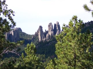 We left the buffalo behind (and by the way, the song is correct: you CAN’T rollerskate in a buffalo herd) and found our way out of the park and back onto 16A, which we took briefly west and then turned left on 87 North, the Needles Highway. Needles is so named because of the sharp, pointed rock formations that are visible from several points near and far from this road. It’s equally as beautiful as Iron Mtn. Road with more tunnels, S-curves and switchbacks to keep a rider focused and challenged. We paused for a break at one particular turnout that had a beautiful view of the Needles formations, then continued on to a point where we were actually on a pass (with one-lane tunnel) through the needles. There was a large turnout area where you could stop to photograph these very unusual formations. It was extremely crowded, and it was at that point that I began to feel like we were really missing a LOT because of the traffic. We stopped for a few pictures of one formation called Eye of the Needle, so named because a long narrow hole in the rock looks exactly like the implement it’s named for. I noticed immediately – as I’m sure others have before me – that if you take a few steps to the left and take a similarly-angled photo, the rock formation actually looks like female genitalia. (I’ve included both pictures, one of the Eye of the Needle and One of Vulva Rock, for comparison purposes.)
Our conversation had turned to noting that after about three hours of managing twisties, switchbacks, S-curves and 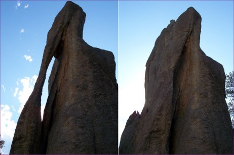 tunnels, we were beginning to get tired of “working so hard” at having fun – make no mistake, we were on vacation, but it IS mentally exhausting and physically challenging to ride so many miles of these kinds of roads in such heavy traffic! This situation is made even more challenging by what the map doesn’t show you: that all these twists and turns are often on an uphill, followed by an immediate turn to the downhill. It required far more “management” and thinking than I had anticipated to ride the roads safely. So by the time we left Eye of the Needle we were anxious to be on the way home. I was calculating that we had about 80-some miles to go, and it was already about 5 p.m. – I hadn’t thought we would be gone that long!
We re-traced our route on 385, stopping for gas in Hill City where I refused to wait in line and ended up using the men’s restroom, onto 85 then 90 and 85 again into Belle Fourche. I swear, that last ten miles from I-90 to Belle Fourche was excruciating! I had never wanted to be at a destination so badly in my life! We pulled into the motel parking lot sometime between 7 and 7:30 – Shirley had returned safely hours earlier from Deadwood. Mileage for the day was 216 – a good deal less than the two days we’d ridden to get to Belle Fourche in the first place, but far more physically demanding than those two days! A late supper and into bed early this night, as Devil’s Tower awaited us in the morning.
Sturgis 2006: Day 5, Devil’s Tower
by Corn Dog on August 22, 2006
in Sturgis 2006
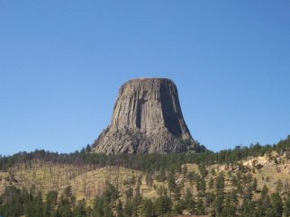 Well if it’s Wednesday of Sturgis Rally Week, it must be time to go to Devil’s Tower. That’s because Wednesday used to be “No Panties Wednesday” in Hulett, WY, which is just east of Devil’s Tower, so of course everyone would stop in Hulett for a view of no panties and then press on to Devil’s Tower. For whatever reason, Hulett doesn’t officially condone “no panties Wednesday” anymore, but everyone still goes to Devil’s Tower on that day. And, despite advice from several online friends encouraging us to go to Devil’s Tower on any day other than Wednesday, one member of our party said, “You HAVE to go on Wednesday – everyone goes on Wednesday.” So on Wednesday, we took off from Belle Fourche, headed west on Highway 34. In just a few miles we approached a “Wyoming Welcomes You” sign, so of course we had to stop for a photo… didn’t pause long, and soon 34 turned into a very nice scenic road with lots of great sweepers. Unfortunately, it was again such heavy traffic that enjoying the scenery was nearly impossible. The first sign that Hulett might be crowded was the fact that motorcycles were lining both shoulders of the two-lane highway a half-mile outside of town and all the way in. We arrived in Hulett and rode through on the main street – stop and go just like going into Sturgis had been on Monday, only it was a smaller and tighter space so it felt more claustrophobic. I didn’t notice “no panties” anywhere – maybe the guys did, they were probably on the lookout – but we got through Hulett after nearly losing our leader and shot out the other end, pressing on toward Devil’s Tower.
Again, traffic. Holy crap, you can’t believe the traffic! We arrived at the Devil’s Tower Trading Post, noting that the day 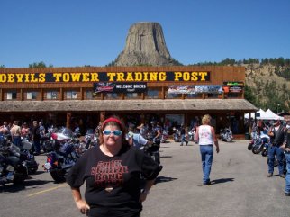 had really heated up while we were en route. And there behind the building was that fabled formation (“gonna build… gonna build a mountain in my living room…”) … looking a little like a giant nipple caught in a tourist trap, hiding as it was behind a souvenir shop… but still, very damned impressive. Did I mention it was hot? At least, I was over-heated and cranky by the time we arrived… spent a little time shopping in the souvenir store, where I learned that DT is actually a failed volcano eruption – a giant bubble of seering lava that attempted to erupt, but ‘froze’ before it bubbled over, within the earth… and the earth around it eroded away, leaving the “tower” we see today. Of course this didn’t just happen last week or last century, it happened millions of years ago… and in fact, the Black Hills area is the result of erosion so it’s not too surprising to learn that’s how the tower was formed. Still, it’s almost incomprehensible to think the earth used to be that much TALLER, and that this tower was in fact a column inside the earth. As a tribute to this monumental achievement of nature, I selected a couple of t-shirts and a trinket for my daughter, and joined the rest of our small group for lunch across the road in the campground restaurant.
One thing we didn’t do that I now wish we had, was pay the Park Usage Fee and ride the road that actually goes up TO the tower and around behind it. I’m not sure what’s back there – maybe a private supper club or something – but for whatever reason we elected not to do that. Leaving the area felt like the thing to do at the time, though to me it also felt premature. This was the time in our trip where I felt the strongest that we were just bouncing from place to place, not really able to enjoy anything to its fullest but just going there to say we’d gone there. It was the day that made the strongest case for returning to the Black Hills at some other time of year.
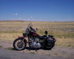 At any rate, we left the Tower and took a very different route home: instead of going through Hulett again, we turned off just outside of town and took Highway 212 north and east back to Belle Fourche. This route was much longer, but almost desolate as far as other traffic. Easy to feel you could be in a lot of trouble if you were traveling alone, simply because no one would come along for quite some time if you needed help. The views were beautiful and far-reaching, though, and the road also took us through a tiny corner of Montana (another “Welcome” sign to photograph!) where we found a great little convenience store to gas up and take a Powerade break. The last leg of the trip took us straight into Belle Fourche at the north end of town. This day was probably the least enjoyable of the whole trip – by the end of it I was hot, crabby and frustrated at feeling like we were going lots of places but not really being there. Devil’s Tower is an awesome sight, no doubt about it – but I didn’t feel I’d really seen it. Undaunted, we turned in early after discussing our plans for the next day – a day-long trip to Spearfish Canyon and Deadwood.
Sturgis 2006 Day 6: Spearfish Canyon & Deadwood
by Corn Dog on August 21, 2006
in Sturgis 2006
If I had any thought that the frustrations of the previous day were going to continue for the rest of the trip, I was, happily, incorrect. We didn’t have a firm plan for Thursday until right before we went to bed Wednesday night. Garry and Shirley had planned to return to Sturgis, and Steve and I decided that we would spend the day on another scenic ride, this time through Spearfish Canyon and down to Deadwood, where we’d visit the graves of Wild Bill Hickok and Calamity Jane.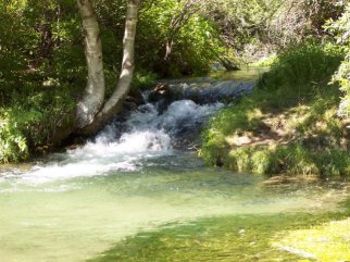 We left Belle Fourche heading south on Hwy 85, a short 10-mile jaunt down to Spearfish. In Spearfish we picked up the Canyon Road near the east end of town and headed south. Even more than Iron Mountain Road and Needles Highway, Spearfish Canyon Road showed off the unique landscape of the Black Hills: sheer, fossil-rich bluffs topped with evergreen Ponderosa and Spruce pine trees, and Spearfish Creek ambling along the side of the road with its crystal-clear mountain water. The road is a two-lane path of gentle turns and sweeping curves, always with a beautiful bluff around the bend. Again, though, because of the traffic and the unpredictable frequency of the turn-outs, it was impossible to know when a photo opportunity would present itself. We
 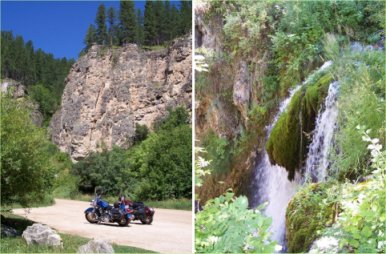 did get a few very good pictures (see gallery linked above), but I also located this great website that tells about the Canyon and shows it off far better than we could capture.
We enjoyed a 14-mile cruise through the canyon down to a wide spot in the road called Savoy, where my internet guides had suggested we take a turn-off down a short gravel road to a spot where we would be able to view Roughlock Falls, a lovely waterfall featuring a moss-covered drop and a well-maintained trail for close-up viewing. (The term “roughlock” was a method used by pioneers for locking the wheels of their wagons so that they could slowly and effectively “skid” down the steep hillside in a controlled manner without overpowering the horses.) We took several pictures at the falls and along the road leading to the viewing area. A little of the hurried pace from the previous day still remained, but we managed to relax a little in spite of it. We left the Savoy Lodge area and continued on down Spearfish Canyon Road to Cheyenne Crossing, where we then picked up Highway 85 east to the small town of Lead and then into Deadwood. We parked in a city lot and walked through a narrow alleyway onto Main Street, coming out at the entrance to the Bullock Hotel and across the street from the original location of Nutall’s #10 Saloon.
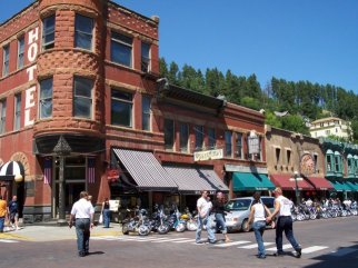 Fires and floods were a fact of life in Deadwood’s early history, so the original #10 (named for it’s location on the original city plat map) where “the assassin Jack McCall” shot and killed Wild Bill Hickok in August, 1876 is long since gone. While the #10 relocated to a better spot up the street following an 1879 fire, in its original location is now a small tavern called the Eagle Bar which tells the story of Wild Bill’s last moments (and McCall’s subsequent trials for the killing) in an interpretive exhibit and daily re-enactment. We drank a toast to Wild Bill and browsed the exhibit, then left the Eagle Bar in search of lunch. Despite our love-to-hate relationship with Ian McShane as the sleazy and murderous Al Swearingen on HBO’s “Deadwood” TV series, The Gem today proved a little too swanky for our lunchtime needs so we had cheeseburgers and buffalo burgers across the street in Wild Bill’s Cafe. Sitting at lunch, we talked about how it was difficult to really become immersed in the history of the town when the streets were lined with gleaming motorcycles and the casinos rang with
  the notes of computerized slot machines. Still, it was interesting to note that the entire town is a National Historic District, with modern gambling funding virtually all of the restoration of the town’s buildings. After lunch we stopped in a few shops along Main Street, where I bought a couple of books that might tell us more.
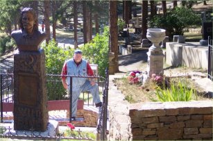
After an hour or so of browsing and people-watching, we headed back to the bikes to locate Mt. Moriah Cemetery (“Boot Hill”) and the graves of Wild Bill and Martha “Calamity Jane” Cannary Burke. We didn’t have a detailed map but I had recalled seeing a sign pointing the way so we headed in that direction. It was stop-and-go up Main Street, and in fact we had to make the pass a couple of times to find the right turn. Because our waiter back at the cafe had mentioned that Mt. Moriah was set in a hillside, I knew we had found the right road when we turned a corner and the road became a steep incline. This was a bit of a challenge on the bike, especially because the top of the hill featured a sharp left with an immediate downward angle. We got the bikes parked and paid the small fee (funds used to maintain the grounds, since all burial plots have long been sold) and took the short walk to Hickok’s and Burke’s adjacent graves. The well-maintained graves are surrounded by iron and chain-link fence. We took several pictures, and I also walked a short distance to an overlook where one could get a nice photo of much of Deadwood. Other early Deadwood leaders, including Sheriff Seth Bullock and Preacher Henry Weston Smith, are also buried here.
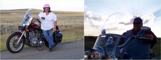 We stopped briefly in the small gift shop adjoining the cemetery and then left Mt. Moriah behind, deciding to ride Spearfish Canyon again in the return direction. Again, though the turn-out locations were unpredictable, we stopped a couple of times for photos and then cruised into Spearfish, where we picked up 85 North for the short 10-mile ride back to Belle Fourche. We took the opportunity of the remaining daylight to return to Highway 212 at the north end of town, where we rode a few miles west of town and took pictures of each other on the bikes. We got some very pretty pictures as the sun began to set, then ended the day with supper at a very good steakhouse in Belle Fourche. It was a day that peaked my interest in learning the true history of Deadwood (as opposed to the HBO version). For our last day of leisure, we would return to Sturgis for the Rat’s Hole Custom Bike Show, then (hopefully) return to our rooms early to pack for the trip home.
Sturgis 2006: Day 7, Rat’s Hole Custom Bike Show
by Corn Dog on August 20, 2006
in Sturgis 2006
 Friday was our last day in the Black Hills, so our plan was to head back down to Sturgis to see the Rat’s Hole Custom Bike Show at Thunder Road, and try to be back mid-afternoon so we could start packing the bikes for the ride home beginning Saturday. We took the same route into town we’d taken on Monday, past Bear Butte and entering the rally area just past the Thunder Road parking lot. The day was already heating up by the time we got parked, and would eventually top out at about 111 degrees. But, as they say, “it’s a dry heat.” Somehow that’s supposed to mean it doesn’t *feel* as hot as humid heat, but 111 is hot and I don’t care who y’are. Anyhoo, parked the bikes and took in some vendors around the perimeter of the building, including an artist who does custom chrome engraving through his business, Chrome Fusion. Steve had considered buying a USMC derby cover from them at one time, but didn’t have a good idea of the quality level. After seeing them in Sturgis, there was no question that every piece was high quality and highly custom. I stopped into yet another Hot Leathers tent and this time purchased a nice braided vest that fits me a whole lot better than the patch-leather one I bought a couple years ago. We also browsed a bit in the Bunny Ranch booth… I almost bought a t-shirt that said “There’s no business like ho business,” but chickened out.
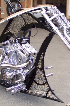
We paid the admission fee for the custom bike show and took some time looking at all the awesome customs. The show 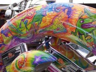 featured 24 of the industry’s best bike builders, and artwork by photographers Timothy White and Michael Lichter, bike painter Joe Richardson and multi-media artist Robert Pradke. I especially enjoyed looking at the restored Harley baggers, and there were a couple bikes painted in a 60’s psychedelic style that I really liked. Of course, there was something special about each and every bike. We saw the Indian Larry “twisted downtube” bike, and there was one bike that had all these beautiful panels of engraved chrome that looked like leather tooling that drew me in. Steve was very interested in the mechanics of a gear-drive bike, but probably the most unusual bike we saw was one where the frame looked like a crouching skeleton, arms outstretched to create the forks. I enjoyed the ‘rat bikes’ too, with all the junk attached to them in such a random fashion that it actually looked artful. These bikes are the cream of the crop in the custom world – some of them truly seemed more sculpture than motorcycle.
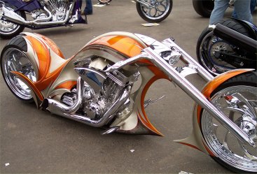 We didn’t stick around long enough to see the trophies awarded, but the show was certainly well worth the visit. Around 2 p.m. we said good-bye to Sturgis and headed back to Belle Fourche, where we spent the afternoon figuring out how to pack an additional third of “stuff” into our luggage. One would think this would be the end of our adventures, with only a long and boring ride home ahead of us. As it turned out, there were still a couple of challenges awaiting us for the last two days of our trip.
Sturgis Days 8 & 9 – Riding Home
by Corn Dog on August 20, 2006
in Sturgis 2006
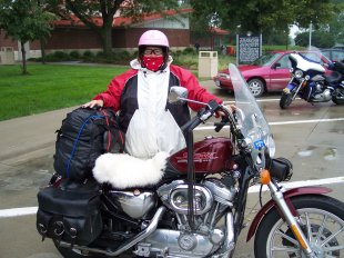 On most vacations, by the time it’s time to go home, you’re ready. Ready to sleep in your own bed, ready to get the long return trip behind you. We had a slightly different mindset for the return trip from the Black Hills, considering the last two days to be just as much a part of the vacation as the first two had been.
That attitude meant that it wouldn’t really be over til we pulled into the driveway. So, rather than pouting about the end of our vacation, we set out for the two day ride home with the thought of enjoying the two remaining days of vacation. It immediately became apparent, upon hitting Interstate 90 on Saturday morning, that this was going to be a difficult mindset to maintain. Why? Crosswind. I never did figure out what the wind speed was that day, but it amounted to constant, insistent battery from the south as we headed east across South Dakota. Maybe 30 mph crosswinds? I’m not a good judge… but I do know that back home, winds at 15-20 mph can be uncomfortable on a lighter bike. Anything higher than that is completely undesirable. And the crosswind in South Dakota on August 12 was a couple notches above completely undesirable.
We left Belle Fourche around 6:30 a.m. and hit our first gas stop (Wall) around 8:30. From there, we stopped very 80-90 miles for gas and to get out of the wind. I gained a lot of knowledge and experience about how vehicles moving 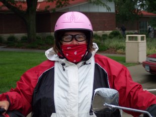 through a crosswind react to each other, and how to handle my bike, but I can’t say it was a lot of fun. First of all, it seemed everyone was going home that day: bikes, pickups with trailers, motorhomes, 18-wheelers. Now I’m no speed demon, and the crosswinds in fact made whatever speed you were really going feel like about 40 mph. But there were times, like on inclines, where we would come up behind another vehicle and it seemed logical to pass in the left-hand lane. Passing other bikes was not a huge deal. Passing the pickups with trailered bikes wasn’t bad either. But the motorhomes and 18-wheelers – well, there came a point where I decided I just wasn’t going to pass them anymore.
Our destination that day was Beresford, SD, a small town about 40 miles south of Sioux Falls – that would make it a 450-mile day. We hit Beresford around 6 p.m. and checked into our motel. What it didn’t take us long to figure out was that this was also the motel where several members of the Outlaws motorcycle club (and at least one of their friends from the Sons of Silence), were staying on their way home. This was a little unsettling because the Outlaws had made big news earlier in the week when several of their members had been shot by members of the Hell’s Angels in Custer State Park – the very day that *we* had visited the same location. There were no problems from this crew, however. We ordered supper in and actually turned in while it was still light outside.
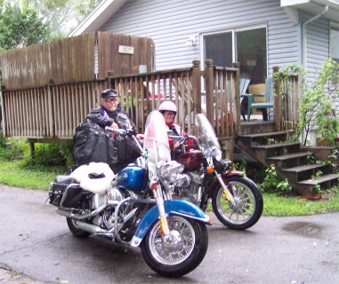 The next morning brought rain, and although we dawdled awhile to see if it would let up, it didn’t. One of the Outlaws politely offered to move his bike so we could get out to leave, so we suited up and took off around 9 a.m. It was a day of on-again/off-again rain showers, but it was far more comfortable than the wind had been the day before. One tip we tried here that worked was that we wore our bandanas over our faces to keep from drinking truck wash in the rain and to keep the rain itself from pelting our cheeks. This looked weird but worked very well. Only two gas stops on our last day – one at Onawa and one at Walnut (where we met a guy heading home to Connecticut, who had left Sturgis that morning and hoped to make it past Chicago by the end of the day – our little 250-mile day sure seemed puny by comparison!). Before we knew it we were on I-235: the freeway that cuts through Des Moines, nearly home. I took special care not to have any problems in the last 10 miles of the trip, and we pulled into our driveway around 3:30 p.m. where we were greeted enthusiastically by our 12-year-old daughter.
We had done it! Nine days, 2,073 miles, and a true sense of accomplishment – at least for me. It would be a week before I’d get the bike down to the car wash to remove the trace evidence, but the thrill of having planned and executed this little adventure is hanging in there still.
Sturgis 2006: We’re back!
by Corn Dog on August 18, 2006
in Ride Reports, Sturgis 2006
We are back from a nine-day trip to Sturgis and the Black Hills! I’ll be adding day-by-day ride reports and lots of photos over the next couple of weeks, so stay tuned! Here’s the quickie recap, though, in case you’re curious how we allotted our time:
Days 1 & 2: Leisurely ride to Sturgis (actually Belle Fourche) from Des Moines, with overnight stop in Mitchell, SD
Ride Report Photo Gallery
Day 3: Spent in Sturgis, walking around and gawking
Ride Report Photo Gallery
Day 4: Scenic Trip to Mt. Rushmore, Iron Mtn. Road and Needles Highway
Ride Report Photo Gallery
Day 5: Scenic trip to Devil’s Tower
Ride Report Photo Gallery
Day 6: Scenic trip to Deadwood via Spearfish Canyon & Roughlock Falls
Ride Report Photo Gallery
Day 7: Back to Sturgis for the Rat’s Hole Custom Bike Show
Ride Report Photo Gallery
Days 8 & 9: Leisurely ride home
Ride ReportWhat a totally awesome and beautiful trip! And I rode it – 2,075 miles – on a frick’n SPORTSTER!!
Some Sturgis 2006 Stats
by Corn Dog on August 17, 2006
in Sturgis 2006
Here are a few stats regarding Sturgis this year, in case you’re interested. They’ve all come from articles in the Rapid City Journal.State level reporting: 259 DUI arrests in the Sturgis area during rally week, compared to 212 during the 2005 rally. 200 misdemeanor drug arrests and 35 felony drugs arrests, which are similar to last year’s numbers. 61 injury accidents and 17 noninjury accidents for the 2006 rally. There were five fatal accidents in the third district of the Highway Patrol, which includes Sturgis, Rapid City, the Southern Hills and the Badlands. In the Sturgis area, the Highway Patrol responded to three fatal accidents this year. It responded to two in 2005. County Level: The Meade County Sheriff’s Office reported one traffic fatality, and handled 1,217 calls for service throughout rally week, compared to 1,197 last year. The sheriff’s office reported 443 total arrests – which is down from last year – and no drug-related felonies. It handled 28 DUIs and made eight domestic-violence arrests. City Level: The Sturgis Police Department made 25 DUI arrests. Sturgis police responded to seven injury accidents and 38 noninjury accidents. The police department responded to no fatal accidents. The department had six confirmed stolen motorcycles. He reported 61 misdemeanor drug arrests, three felony drug arrests and 14 arrests for assault. Throughout Sturgis, the PD made 161 nontraffic arrests and 167 traffic arrests. They reported no further gang-related violence after the Aug. 8 shooting at Custer State Park, in which five people were injured.
One report from August 9 says a man was stabbed to death in an altercation on “Da Bus,” one of the event shuttle buses running near the Creekside Campground. And the aforementioned Journal reports that “bikers spent less money despite having more vendors to choose from,” citing a decline in gross sales evidenced by a decline in state sales and tourism taxes. A common theory suggests that area revenues are down because the rally is spreading outside of Sturgis and the immediate region.
